


MARTIN Voting District, McLean County, Illinois
About
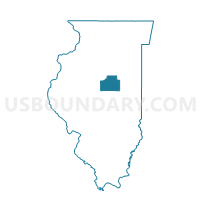
Outline

Summary
| Unique Area Identifier | 573030 |
| Name | MARTIN Voting District |
| County | McLean County |
| State | Illinois |
| Area (square miles) | 36.24 |
| Land Area (square miles) | 36.23 |
| Water Area (square miles) | 0.01 |
| % of Land Area | 99.98 |
| % of Water Area | 0.02 |
| Latitude of the Internal Point | 40.52457250 |
| Longtitude of the Internal Point | -88.62713830 |
Maps


Graphs
Select a template below for downloading or customizing gragh for MARTIN Voting District, McLean County, Illinois


Neighbors
Neighoring Voting District (by Name) Neighboring Voting District on the Map
- ANCHOR Voting District, McLean County, IL
- ARROWSMITH Voting District, McLean County, IL
- BLUE MOUND Voting District, McLean County, IL
- CHENEYS GROVE Voting District, McLean County, IL
- CROPSEY Voting District, McLean County, IL
- DAWSON Voting District, McLean County, IL
- LAWNDALE Voting District, McLean County, IL
- LEXINGTON 2 Voting District, McLean County, IL
Top 10 Neighboring County Subdivision (by Population) Neighboring County Subdivision on the Map
- Lexington township, McLean County, IL (2,399)
- Martin township, McLean County, IL (1,289)
- Cheney's Grove township, McLean County, IL (997)
- Dawson township, McLean County, IL (590)
- Arrowsmith township, McLean County, IL (502)
- Blue Mound township, McLean County, IL (441)
- Anchor township, McLean County, IL (286)
- Cropsey township, McLean County, IL (222)
- Lawndale township, McLean County, IL (158)
Top 10 Neighboring Place (by Population) Neighboring Place on the Map
Top 10 Neighboring Unified School District (by Population) Neighboring Unified School District on the Map
- Tri-Valley Community Unit School District 3, IL (4,680)
- Ridgeview Community Unit School District 19, IL (3,513)
- Lexington Community Unit School District 7, IL (3,014)
Top 10 Neighboring State Legislative District Lower Chamber (by Population) Neighboring State Legislative District Lower Chamber on the Map
Top 10 Neighboring State Legislative District Upper Chamber (by Population) Neighboring State Legislative District Upper Chamber on the Map
Top 10 Neighboring 111th Congressional District (by Population) Neighboring 111th Congressional District on the Map
Top 10 Neighboring Census Tract (by Population) Neighboring Census Tract on the Map
- Census Tract 57, McLean County, IL (5,144)
- Census Tract 56.02, McLean County, IL (2,212)
- Census Tract 56.01, McLean County, IL (1,889)